As the oldest continually inhabited place in the United States, downtown Tucson has a long and multicultural history.
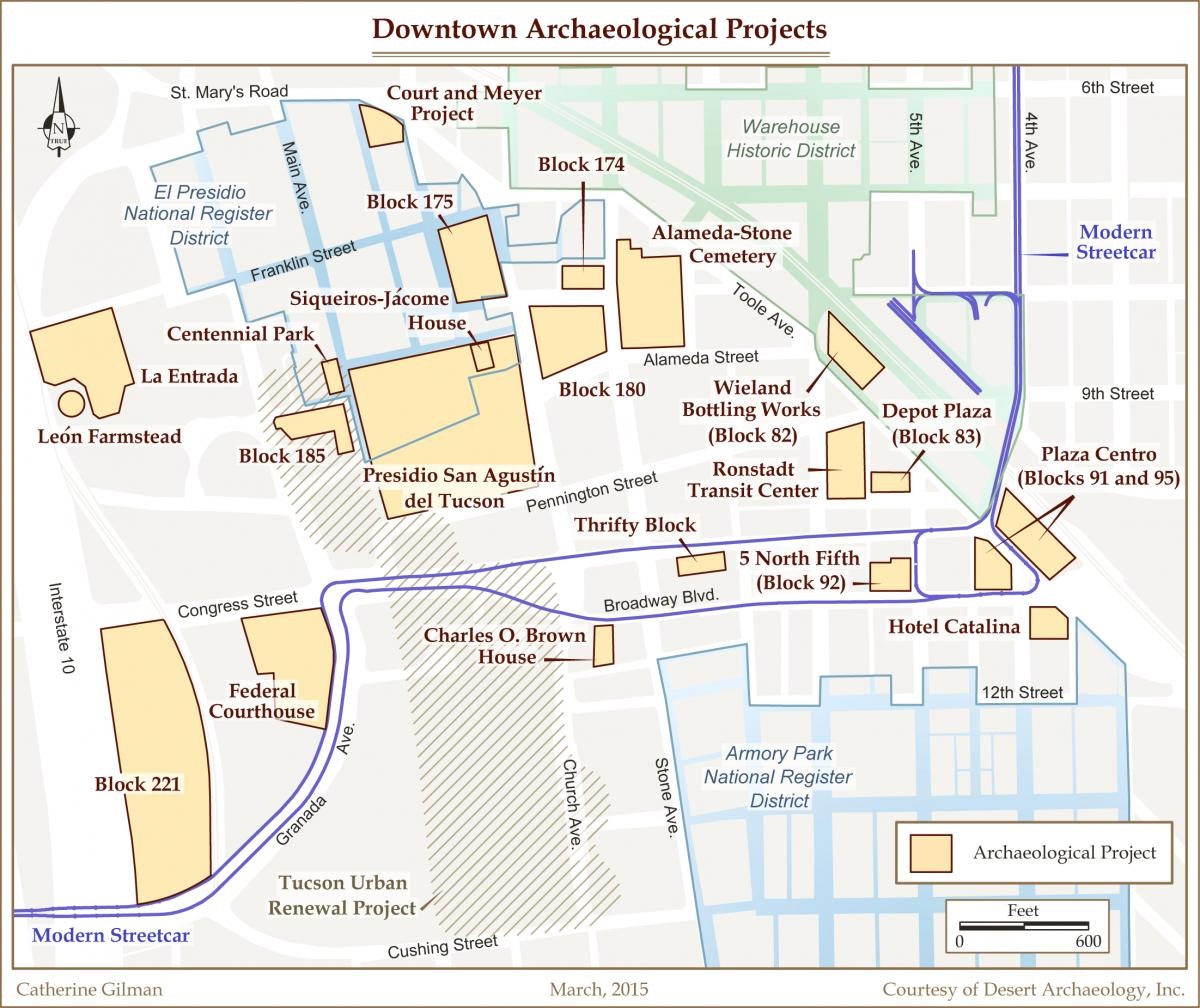
Map of Major Archaeological Projects in Downtown Tucson(PDF, 3MB)
This map of downtown Tucson prepared by Archaeology Southwest shows major archaeological projects and National Register districts.
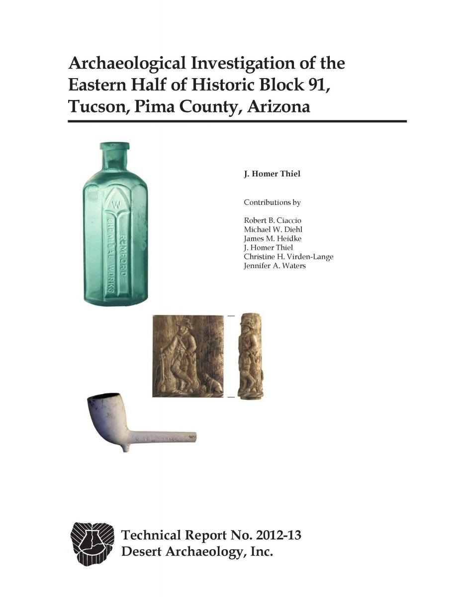
Archaeological Investigation of the Eastern Half of Historic Block 91, Tucson, Pima County, Arizona(PDF, 24MB)
Archaeological excavations were conducted on the eastern half of historic Block 91 in September and October 2011 for the City of Tucson. Archaeological and archival research indicated that area was first settled in 1883, when a pair of duplexes were constructed. Development was stagnant until the early 1900s ,when rental housing, a planing mill, and a set of commercial buildings, including a hotel and restaurant, were constructed. Gradually, the area transformed into a commercial area where Tucson residents could purchase and repair automobiles, shop for groceries, or obtain a meal at a restaurant. In 1957, the area was cleared for use as a parking lot. Later the Greyhound bus terminal was constructed and was in use into the early 2000s.
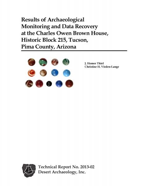
Results of Archaeological Monitoring and Data Recovery at the Charles O. Brown House, Historic Block 215, Tucson, Pima County, Arizona(PDF, 2MB)
Plans to renovate portions of the historic Charles O. Brown House and its adjacent courtyard in 2011 led to archaeological monitoring on the exterior of the house and the excavation of portions of the house interior.

The 6th and Toole Project: Tucson Warehouse Historic District(PDF, 6MB)
This report provides detailed information about the archaeological remains uncovered at the northeast corner of 6th and Toole Avenues near the former Southern Pacific Railroad Depot. The project area was the former location of various residential and commercial enterprises associated with the railroad and represents the remains of some of Tucson’s earliest warehouses.

Additional Archaeological Historical Research in the Presidio, Historic Block 181, Tucson, Pima County, Arizona(PDF, 26MB)
Excavations reveal that Block 181 contains a wealth of cultural resources. Prehistoric pit structures dating to the Early Agricultural and Hohokam periods are common. Tucson Presidio era features include trash-filled pits and adobe foundations. American Territorial period features include the standing Siqueiros-Jácome House, as well as privies, wells, and large trash-filled borrow pits.

Archaeological Data Recovery at El Parque de Diego y Orlando Mendoza, Lot 10 of Block 247 in the Barrio Libre Historic District, Tucson, Pima County, Arizona(PDF, 20MB)
This report details the results of archaeological investigations undertaken during the El Parque de Diego y Orlando Mendoza project in Historic Barrio Libre. Archaeological investigations revealed the remains of an adobe rowhouse that once served as a residence, a blacksmith shop, and a corner store.

Archaeological Excavations of the Hooper Warehouse, the Tucson Sampling Works, and the Southern Pacific Railroad Clubhouse, Historic Block 95(PDF, 5MB)
Archaeological data recovery documented the physical remains of the Hooper warehouse (1880-circa 1887), the Tucson Sampling Works (1887-1901), and the Southern Pacific Railroad Clubhouse (1906 circa 1964). Features associated with the buildings yielded artifacts and food remains providing significant data on the lives of the residents and workers associated with the property between 1880 and 1901.

Archaeological Investigations and Data Recovery at Historic Block 83, Tucson, Pima County, Arizona(PDF, 6MB)
Archaeological excavations at historic Block 83 revealed a large artifact assemblage associated with the former boarding houses, hotels, and saloons located on the block. The features, food remains, and artifacts provide the first look at a late nineteenth and early twentieth century commercial block in downtown Tucson.

Archaeological Investigations at AZ BB:13:756 (ASM) and AZ BB:13:757 (ASM) Historic Block 185, Tucson, Pima County, Arizona(PDF, 3MB)
Archaeological excavations at Historic Block 185 documented features from two subsurface archaeological sites, AZ BB:13:756 (ASM) and AZ BB:13:757 (ASM). BB:13:756 including soil mining pits, where material to manufacture adobe bricks for the Tucson Presidio was collected, and the foundations of twentieth century dwellings. BB:13:757 consisted of portions of two canals, one dating to the Prehistoric era and one filled with Territorial-era trash.

The Discovery of the Francisco Romero House and Presideo-era Mining Pits: Archaeological Testing of Centennial Park, AZ BB:13:756 (ASM), Tucson, Pima County, Arizona(PDF, 12MB)
Technical Archaeological testing was conducted within the location of Centennial Park. An American Territorial house foundation associated with Francisco Romero, a prominent resident of Tucson during the American Territorial period was located and dates to the 1870s. An adobe brick bread oven was found nearby and predates the Romero house, probably constructed in the 1850s or 1860s. Below the foundation, Presidio-era (1775-1856) artifacts were found in borrow pit features.

Joint Courts Complex Archaeological Project
In 2006, Pima County initiated one of the largest and most complex archaeological excavations ever undertaken in the state. Because the entire parcel was planned to be developed into a City-County Courts Complex, state law required the complete recovery and removal of burials from the site and repatriation to descendants with cultural affinity. The excavation resulted in the recovery of nearly 1,400 individuals buried during Tucson's Territorial Period, together with more than 700 archaeological features dating to the post-cemetery and prehistoric periods.

Rio Nuevo Archaeological Report
This report presents summaries and interpretations of the archaeological features, artifacts, and historical data uncovered during the Rio Nuevo Archaeology program conducted in downtown Tucson between 2000 and 2003 for the City of Tucson. Several major archaeological sites were investigated, including the San Agustín Mission and Mission Gardens, the Tucson Presidio, the Tucson Brickyard, the prehistoric Clearwater site, and numerous historic and prehistoric canals.
Downtown Underground - Teacher’s Guide
This teacher’s guide includes a special introduction to Tucson’s history and elementary classroom activities.
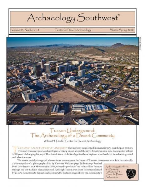
Tucson Underground: The Archaeology of a Desert Community
This 32-page double issue of Archaeology Southwest Magazine looks at 4,000 years of history in the Old Pueblo. Topics include the early agricultural, Hohokam, Spanish Colonial, and modern periods. You may order a hard copy or a pdf.
Fort Lowell was a supply base for the United States Army “Apache Campaigns” between 1873 and 1891. Following abandonment of the fort in 1891, settlers moved in and used some fort buildings as residences. By the 1930s, much of the fort had fallen into disrepair or had been sold off.
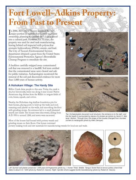
Fort Lowell-Adkins Property: From Past to Present(PDF, 3MB)
This informational pamphlet provides a general description and history of the 2012 archaeological excavations that were undertaken at the Adkins Parcel located at the southwestern corner of Craycroft and Fort Lowell Roads.
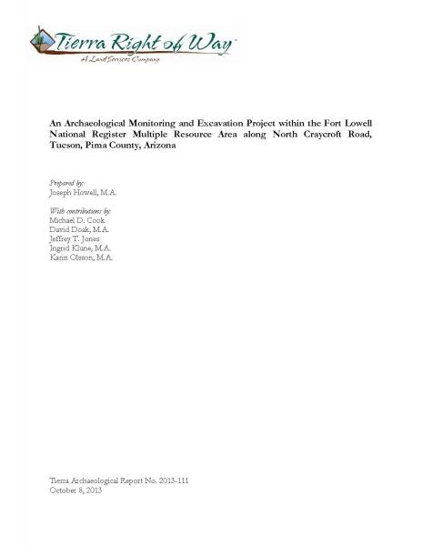
An Archaeological Monitoring and Excavation Project within the Fort Lowell National Register Multiple Resource Area along North Craycroft Road, Tucson, Pima County, Arizona(PDF, 6MB)
In 2001, during the excavation of an underground utility trench, archaeologist identified and excavated the remains of both prehistoric and historic archaeological features along a portion of North Craycroft Road.
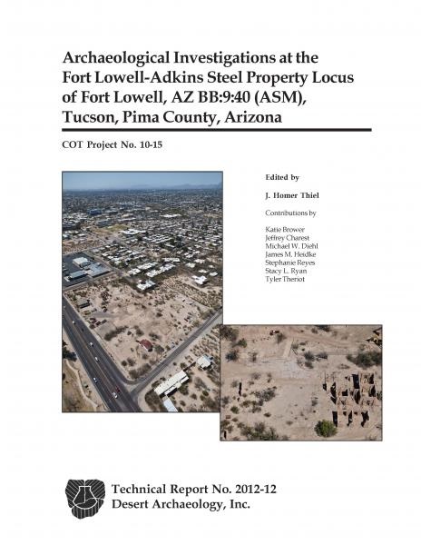
Archaeological Investigations at the Fort Lowell-Adkins Steel Property Locus of Fort Lowell, AZ BB:9:40 (ASM), Tucson, Pima County, Arizona(PDF, 22MB)
As part of the removal of contaminated soil at the Adkins Steel property, archaeologists excavated the remains of both prehistoric and historic archaeological features, including the discovery of agricultural planting pits and the remains of the tree-lined officers’ row.
Read more about the history and archaeology of Fort Lowell
The Court Street Cemetery, located south of the intersection of Stone Avenue and Speedway Boulevard was in use between 1875 and 1909. By 1916, the cemetery had been sold to the City of Tucson and development of the John Spring/Dunbar Spring’s neighborhood had begun. Many of the graves in the Court Street Cemetery were exhumed and relocated to the Evergreen and Holy Hope Cemeteries prior to residential development; however, many graves were left in place.
Archaeological Investigations for the Speedway-Main Monitoring Project and the Excavation of Seven Burials within the Court Street Cemetery, AZ BB:13:156 (ASM), Tucson, Pima County, Arizona(PDF, 15MB)
In 2012, archaeologists identified 11 burials within the former confines of the Court Street Cemetery, excavating seven burials that were in the direct path of a sewer line replacement project.
Identification of the Pima Tribe No. 10, Improved Order of Red Men Plot Within the Court Street Cemetery, AZ BB:13:156 (ASM), Tucson, Pima County, Arizona(PDF, 7MB)
Archaeological testing was conducted at the Salvation Army property located near the southeastern corner of North Main Avenue and West Speedway Boulevard. Work identified 20 graves within the Improved Order of Red Men plot in the Court Street Cemetery, as well as eight prehistoric features.
Excavation, Analysis, and Cultural Affinity Statement of Burial 15 from the Court Street Cemetery, AZ BB:13:156(ASM), Located at the Intersection of Queen Avenue and First Street, Tucson, Pima County, Arizona(PDF, 909KB)
In 2010, during routine maintenance work of a broken subsurface sewer pipe, a historic-age burial was identified by workers of KE&G Construction. The project consisted of the removal of one historic burial (Burial 15) from the Court Street Cemetery. Burial 15 represents the fifteenth grave from the Court Street Cemetery located and recovered since 1949.
Excavation and Analysis of Burials 13 and 14 from the Court Street Cemetery, AZ BB:13:156 (ASM), Tucson, Pima County, Arizona(PDF, 3MB)
The property owner at 904 N. Perry Avenue in Tucson, Arizona, discovered a human burial after a sinkhole opened in the City of Tucson’s right-of-way on his property, which lies within the Catholic portion of the Court Street Cemetery. Two burials in coffins were removed.
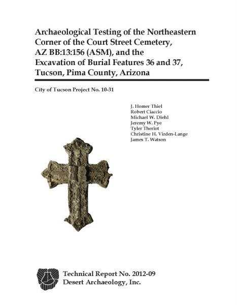
Archaeological Testing of Portions of the Northeastern Corner of the Court Street Cemetery, AZ BB:13:156 (ASM), and the Excavation of Burial Features 36 and 37, Tucson, Pima County, Arizona(PDF, 21MB)
Archaeological testing was conducted in three areas in the northeastern corner of the Court Street Cemetery, which was in use between 1875 and 1909. Two burials were located and subsequently excavated.